A cloud is made up of droplets of water or tiny ice cyrstals.
The classification of clouds into types was first proposed by Luke Howard in 1802 in his book "The
Modifications of Clouds" and we largely use the same system today. This splits clouds into three
main types - stratus, cumulus and cirrus.
Stratus/strato: flat/layered and smooth
Cumulus/cumulo: heaped up/puffy, like cauliflower
Cirrus/cirro: high up/wispy
Alto: medium level
Nimbus/Nimbo: rain-bearing cloud
The World Meteorological Organization (WMO) has extended Luke Howard's classifications to make 10 main groups of
clouds,
called genera. These are divided into three levels - cloud low (CL), cloud medium (CM) and cloud high (CH)
High Clouds (CH)
Fun Fact: the vapour trails left by planes as they fly through a dry upper troposphere are called contrails
and these streaks can spread out and become the three clouds below.
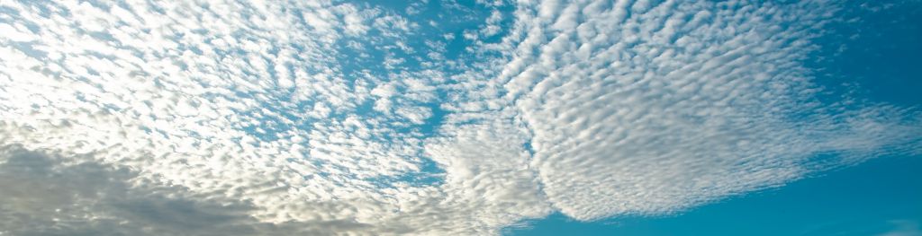
1. Cirrocumulus
Cirrocumulus clouds are often said to resemble honeycomb due to the fact they are made up of lots of
small clouds called cloudlets. These clouds usually are made up of ice and "supercooled" water (water
that remains liquid even at temperatures below 0°c). Cirrocumulus clouds form when turbulent vertical
currents meet a cirrus layer creating a puffy shape. Due to the precipitation never reaching the surface
you can expect fair weather however they often appear before stormy weather!
2. Cirrostratus
Cirrostratus clouds are transparent and cover large parts of the sky spanning up to thousands of miles.
These are one of the few clouds to experience the "halo phenomena" where white/coloured rings, spots or arcs
of light are around the Sun or Moon. Cirrostratus clouds are usually seen at the forefront of weather
systems for instance if Cirrostratus nebulosus are spotted its more than likely an incoming warm front will
bring persistent rain within 24hours!
3. Cirrus
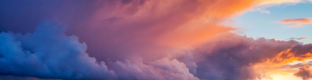
Cirrus clouds look like thin wispy feathers and float at high altitudes. They are noticeably whiter
than any other cloud in the sky during the day, this is because they are completely made of ice
cyrstals. When the sun is setting or rising, they can take on the colours of the sunset, making for a
beautiful sunset.
These clouds often form in advance of a warm front and produce precipitation. However, this
precipitation never recahes the ground. It re-evaporates creating virga clouds most commonly known as
"jellyfish clouds".
Medium Clouds (CM)
1. Altocumulus
Altocumulus appear in a variety of shapes as they are made up of cloudlets (made of ice and water) and will
normally appear white or grey. There is a large variety of Altocumulus clouds and are one of the most
diverse
cloud types with many different species. Some of the key features to identify these clouds are: spotting
vigra (jellyfish clouds), a fallstreak hole (a split or punch like hole in the clouds).
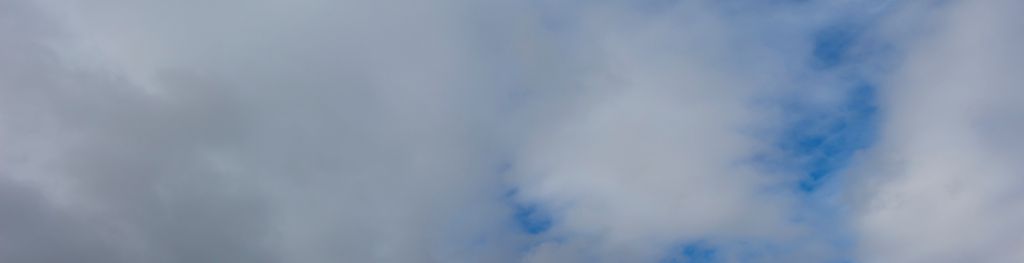
2. Altostratus
Altostratus are known to be grey or blue and very thin and in parts allow you to see the sun through the
cloud. They typically have very few features. They often form when a higher level cloud (cirrostratus)
descends. Due to the fact they are so thin altostratus clouds sometimes contribute to optical effects i.e.
coronas and iridescence. Normally forming before warm or occluded front. Seeing these clouds can indicate a
weather change is coming e.g. Nimbostratus.
3. Nimbostratus
Nimbostratus clouds are "rain clouds". They are thick, dark, grey, featureless layers of cloud that cover
most of the sky. They often bring continous rain or snow. Not to be confused with the low-level Cumulonimbus
cloud that brings hail, thunder and lightning. Similarly to altostratus these clouds are not classified into
species as they lack specific characteristics - featureless.
Low Clouds (CL)
1. Stratocumulus
Stratocumulus clouds are the most common clouds seen on earth characterised by large patches of cloud grouped
in lines or waves varying from bright white to dark grey. They are present in all types of weather
conditions (maybe why they are so common). These low-level clouds are grouped into 4 different species:
Stratocumulus stratiformis, Stratocumulus cumulogenitus, Stratocumulus castellanus and Stratocumulus
lenticularis.
2. Stratus
Stratus clouds cover the sky like a blanket typically white or grey. In its "nebulosus" form they are
responsible for overcast. Stratus clouds are the lowest-lying cloud type more commonly known as mist or fog.
These clouds only when thick enough produce light drizzle and when its cold enough light snow. There are
only 2 species of stratus: Stratus nebulosus and stratus fractus.
3. Cumulus
Cumulus clouds are one of the most distinctive cloud types! They are individual cauliflower shaped clouds
usually spotted in fair conditions and sunny days. These clouds are formed beacuse of convection.
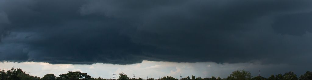
4. Cumulonimbus
Cumulonimbus clouds are "The King of Clouds" or more commonly thunderstorm clouds! They are the only cloud
responsible for hail, thunder and lightning and other severe weather such as tornadoes and blizzards. These
clouds form through convection mostly from small/overdeveloped cumulus clouds. Forced convection is how they
form along
cold fronts. They start as a towering cumulus move to the mature stage and then the dissipating stage. These
clouds individually wont produce extreme weather only short heavy rain for about an hour (most storm cells
die after 20 minutes), however multicell/supercell storms consist of many Cumulonimbus clouds.
When observing these clouds have an impressive height spanning all three cloud levels(CH,CM,CL) There are 3
distinct species: Cumulonimbus calvas, Cumulonimbus capillatus and Cumulonimbus incus.
In big clouds like these you can experience moderate or severe turblence in a plane as the up and downdrafts
of wind are more chaotic.
 1. Cirrocumulus
 2. Cirrostratus
 3. Cirrus